
Forecast models daily run by CLIM lab of ENEA SSPT-MET
info about MITO model
MITO is a high-resolution forecasting model of the circulation of the Mediterranean Sea-Black Sea system which, for the first time, includes the effects of the four main astronomical tides.
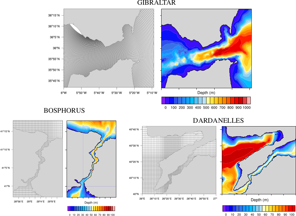
The model is based on the hydrostatic version of the Massachusetts Institute of Technology general circulation model, and its horizontal computational grid, made of 2500 x 750 points, has a uniform resolution of 1/48° (about 2km) over most of the domain, except in three regions where higher resolutions are needed to correctly resolve the local dynamics. As shown in Figure, these are the Strait of Gibraltar, where the grid has been highly stretched, to reach a maximum resolution of 1/800° (about 120 m), and the Straits of Dardanelles and of Bosphorus, where a smooth thinning of the grid in the latitudinal and longitudinal directions allows for a maximum resolution of 1/250° (about 380 m).
At the single open boundary, to the west of the Gibraltar Strait, boundary conditions from on operational model of the Mediterranean Sea circulation are prescribed, whereas surface forcing (hourly wind stress, heat and fresh water fluxes) is derived from a high-resolution (5 km) regional atmospheric model.
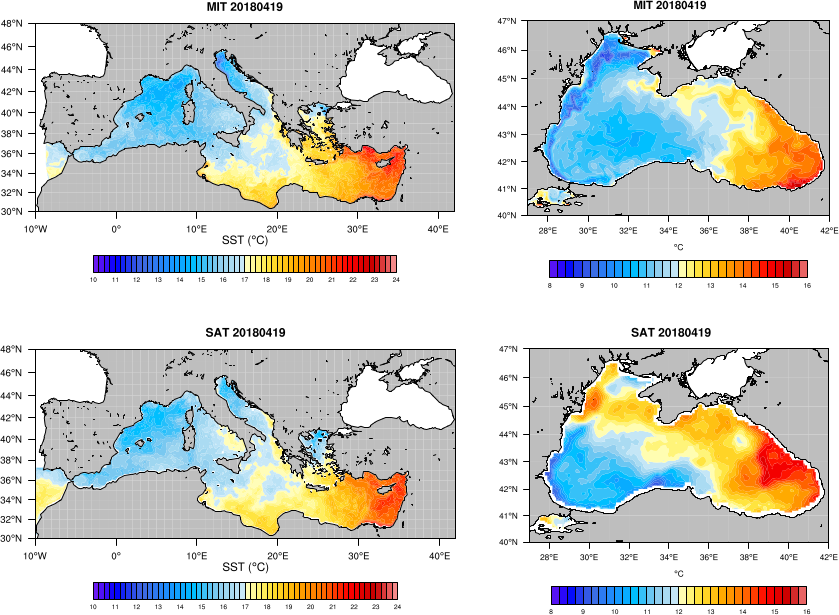
A first physical validation of the model has been performed, comparing the results of a 40 days run (19 March-30 April 2018) with available satellite observations of sea height, sea surface temperature, and turbidity. After one month of simulation, during which no assimilation or relaxation was applied, the model circulation and the sea surface temperature distribution were still found to be in good agreement with the observations, proving the capability of the model to follow the evolution of the system in a period - beginning of spring - characterized by complex dynamics and significant changes in the surface heat fluxes.
The tidal dynamics of the model has been validated through comparison with the results of a tidal inversion software, with reference experimental data, and with tide gauge measurements covering the simulation period. The tides have been found to provide an important modulation of the transport across the Gibraltar Strait and the Sicily Channel, as expected, but also across the Corsica Channel and the Otranto Strait. Effects of the tides on the local circulation have also been highlighted, such as a significant modulation of the strength of some currents: the streams of Atlantic water and Levantine water crossing the Sicily Channel; the northward current through the Corsica Channel; the southward surface stream exiting the Adriatic Sea on the western flank of the Otranto Strait. In these three passages, more complex effects of the tides have also been found, which manifest as clockwise rotations of the flow over shallow bathymetric features (e.g., the Adventure Bank in the Sicily Channel, and the area to the south of the Elba Island).
Spectral analysis of the mean kinetic energy in the Sicily and Corsica Channels has revealed the presence of spectral peaks corresponding to periods of about 8 and 6 hours, which can only be interpreted as harmonics of the diurnal and semidiurnal tidal components, generated true nonlinear interactions. This is an important result, because it shows that in these areas the effect of the tides cannot be correctly recovered by just adding the appropriate tidal signal to the results of a not tide-including simulation.